
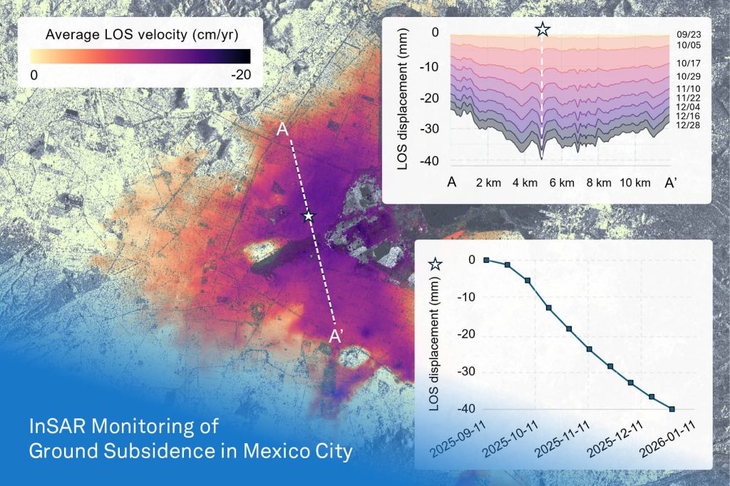
Clifton is expanding our geohazard capabilities with the introduction of spaceborne Interferometric Synthetic Aperture Radar (InSAR) monitoring.
InSAR uses satellite data to measure changes in the Earth’s surface over time, providing valuable information for identifying and monitoring ground deformation. The technology can be applied across natural and engineered slopes, urban areas, dams, roads, railways, tailings facilities, and other infrastructure to help identify displacement patterns and support proactive monitoring and risk management.
To demonstrate this capability, our team used Clifton’s internal InSAR workflow and publicly available Sentinel-1 satellite data to analyze subsidence in Mexico City during Fall 2025. Mexico City is a well-documented example of widespread urban subsidence associated with groundwater extraction. By analyzing Line-of-Sight (LOS) velocity and spatial transects, InSAR can help visualize how displacement evolves across an area and track ground movement with millimetre-level precision over time.
At Clifton, we are developing automated workflows to integrate remote sensing data with traditional geotechnical engineering approaches. By connecting satellite-based observations with ground-level engineering, these tools can translate complex datasets into practical information that supports a shift from reactive mitigation to proactive monitoring, risk assessment, and engineering decision-making for more resilient infrastructure.
