
In July 2025, NASA and ISRO launched NISAR, a new radar satellite that collects L-band data. Its longer wavelength can penetrate vegetation more effectively than the radar wavelengths typically used for InSAR monitoring, providing new opportunities for detecting ground movement in heavily forested regions. NISAR data is openly available at no cost, with global coverage.
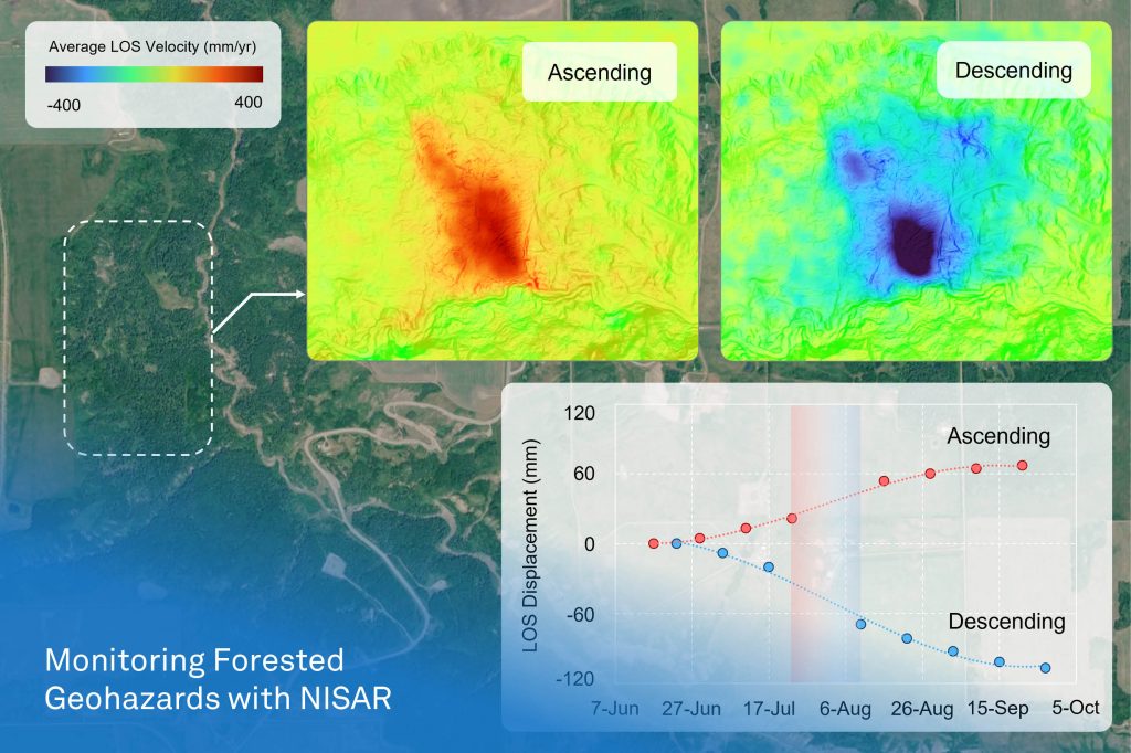
Our InSAR team processed NISAR acquisitions from June to September 2026 over northeastern BC, using both ascending and descending passes, and identified an active landslide in a forested valley.
Over approximately three and a half months, the slide moved roughly 70 mm and 110 mm along the ascending and descending lines of sight, in opposite directions. This pattern indicates predominantly horizontal movement. Combining both passes allows us to separate different components of motion in three dimensions and map the active blocks more precisely. The time series also shows the movement accelerating in late July before slowing by mid-September.
The Peace River region is crossed by pipelines, highways, railways, and hydroelectric infrastructure, and its valley slopes are prone to instability. With NISAR, operators and asset managers can monitor known and previously unidentified ground movement across the region from space, even under dense vegetation. This regional awareness can help target ground investigations, monitoring programs, and remediation efforts where they matter most.
The visualization uses hillshade data from LidarBC and aerial imagery from Maxar Technologies.
